
DNR Asks Residents to Share Flood Photos on MyCoast Maryland
Easy-to-use app helps government officials understand extent of flooding and then plan response and mitigation efforts
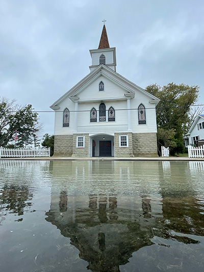
Ewell Methodist Church and Parsonage on Smith Island
A rain storm’s a-brewing and Maryland needs your help to document flooding.
Maryland’s Department of Natural Resources (DNR) recently launched the new MyCoast Maryland app that enables people to easily upload photos of flood conditions in their neighborhood during or after major rain events and tidal flooding.
The flood photos that residents share on the app help scientists at DNR and other government agencies in Maryland understand the extent of flooding in certain areas, compare pre-storm or pre-high tide flooding estimates with actual effects, and plan long-term mitigation projects to reduce flooding.
During DNR’s Science Week in October 2023, Kim Grove, the chief of the Office of Research and Environmental Protection for Baltimore City’s Department of Public Works, discussed how Baltimore is using MyCoast Maryland to respond to and mitigate flooding in the city. She said the photos from the app helps city officials understand community impacts during the storm events and supplement information sent to the city’s 311 and 911 reporting systems. Long-term, the city can also use the photos to identify areas for enlarging pipes, clearing culverts of debris, or taking other actions that could prevent future flooding impacts.
“MyCoast can help us fill in the blanks of our flood response,” Grove said. “It can show us how city infrastructure is impacted by different storms and help us understand what residents are dealing with when flood waters are at their highest points.”
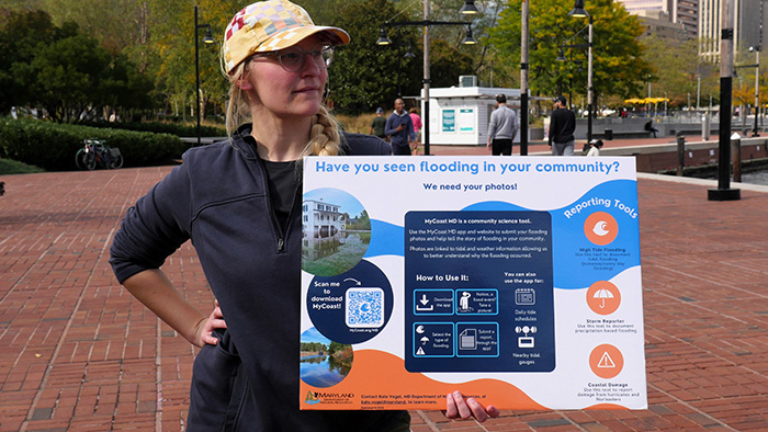
DNR’s Marlo Atkinson holds a sign detailing how to upload photos to the new MyCoast Maryland app that enables citizens to share real-time photos of flood conditions. Photo by AJ Metcalf
Through the app, the MyCoast photos are linked using geolocation information with data from nearby tide gauges, riverine gauges, and weather stations that include wind and precipitation information to give officials insight into the different factors that could be leading to severe flooding in specific areas. DNR urges individuals to be cautious when taking photos of floods and never risk their own safety when doing so.


Click the buttons above to download the MyCoast app on your iPhone or Android device.
“This is a tool that we believe can help people affected by flooding feel heard,” said Marlo Atkinson, science communicator at DNR. “MyCoast Maryland app users can also see other photos that have been uploaded to the app, which can provide greater insight into how your neighborhood and others are faring during a strong rain storm or tidal flooding event. These photos also help ensure that government officials are viewing the conditions on the ground and responding to flooding appropriately.”
While individuals must register to use the app, photos uploaded to the app that can be viewed publicly do not include people’s names. The app can even store photos and information offline if cell service is interrupted during a strong storm, or if service is poor, and then be uploaded onto the app when service is strong or the user is connected to Wi-Fi.
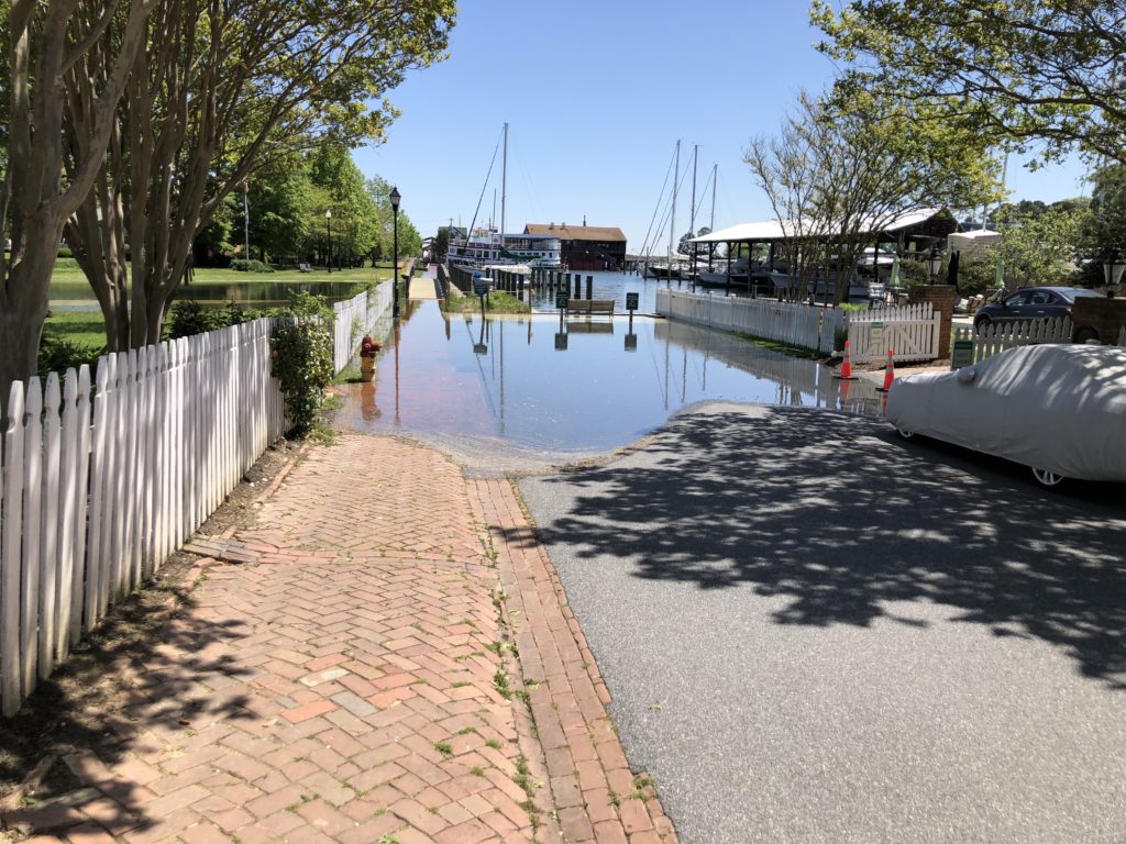
Sunny day flooding in St. Michael’s in 2022. – MyCoast-submitted photo.
The MyCoast photos also help government officials in Maryland see what the real-world effects are after the National Weather Service forecasts storms in mild, moderate, or severe categories. Due to climate change, many moderate or even mild storms can cause severe flooding, especially in coastal areas during high tides. Even localized rain storms that affect small areas can have outsize flooding impacts that may be harder to predict due to a changing climate.
“We had a storm in September in Baltimore where stream levels rose 10 feet in 90 minutes, which caused flooding for residents and local businesses in a specific area,” Grove said. “MyCoast photos, when used with the different data we collect, can help us better understand how these localized floods occurred and what we can do to prevent or mitigate it in the future.”
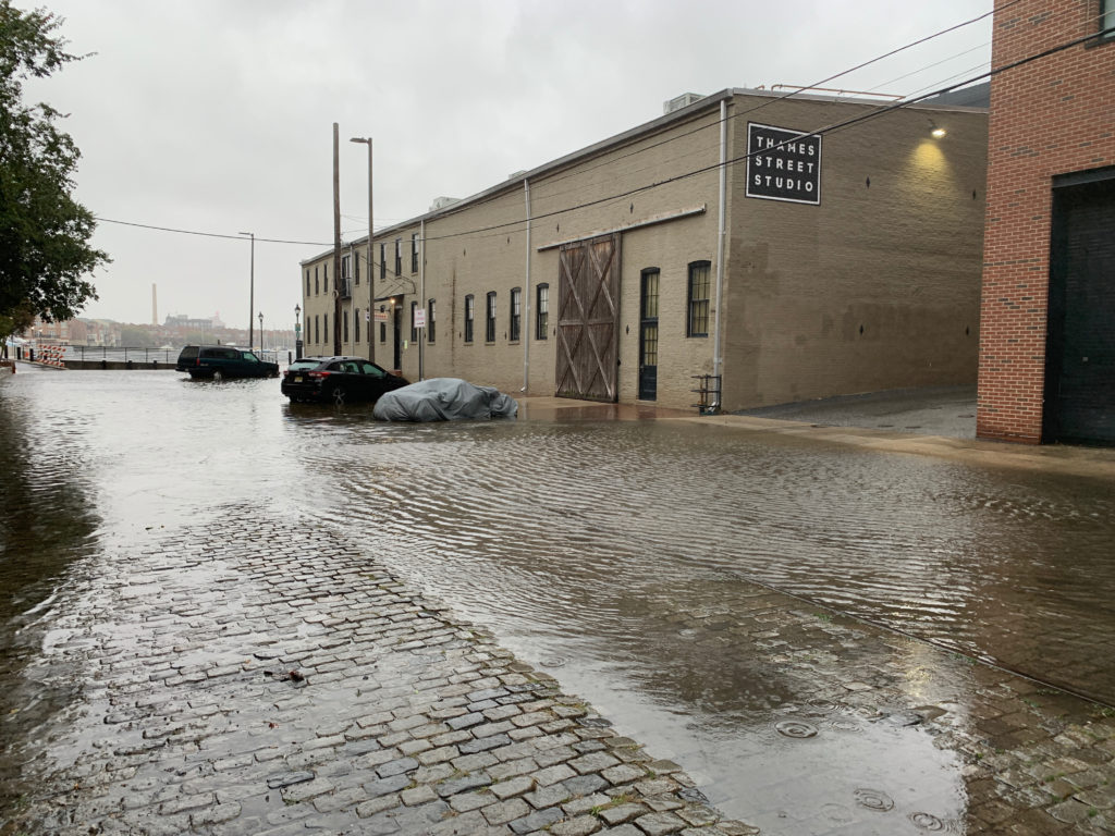
Flooding in Baltimore from during an unnamed coastal storm on Oct. 29, 2021. On this day, the water levels were about 3.4 feet higher than usual due to storm surge and rain. – MyCoast-submitted photo.
Grove noted that 2023 was the 20th anniversary of when Hurricane Isabel struck the region. The storm brought extensive flooding to Baltimore’s Inner Harbor due to a storm surge that occurred after the rain storms had ended. After Isabel hit, the Inner Harbor’s roadways looked like canals, hotels and other buildings were inundated on their ground floors, and significant city infrastructure had to be rebuilt. Grove said that having citizen photos from different angles during that event would have been a huge asset to help the city understand the risks from this powerful rain and storm surge event.
So far, about 1,000 users have registered to upload photos to the MyCoast App, but DNR is hoping many more citizens will download the app to help state and city officials better understand flooding risks. The more photos that are submitted, the more you can help to reduce flooding in Maryland!
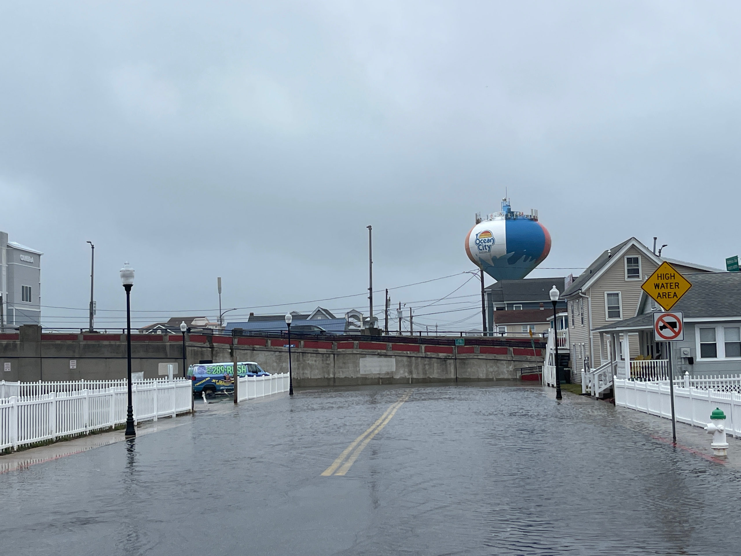
Flooding in Ocean City in 2022. MyCoast-submitted photo.
Article by AJ Metcalf, Communications Director for the Maryland Department of Natural Resources