
Roadmap to Resilience: Climate Change Adaptation and Resilience Guides for State Lands
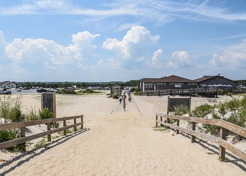
Assateague Island State Park on the perfect summer beach day
Maryland is known for its wildlife and natural resources, with recognizable symbols like the Chesapeake Bay, blue crabs, and the wild horses at Assateague State Park. Every year millions of Marylanders, as well as visitors from around the world, enjoy these attributes and all the recreational opportunities our state lands–park, forest, and other public properties–have to offer.
But all of that is under threat, as Maryland is one of the most vulnerable states to climate change in the United States. Increasing temperatures, changing precipitation patterns, flooding, sea level rise, and invasive species all have an effect on the way our state’s natural resources can be enjoyed. To protect these opportunities and our natural resources, advanced planning, determination, and a commitment to the future is necessary.
During a two-year planning period, staff from the Maryland Department of Natural Resources Chesapeake and Coastal Service initiated a climate change adaptation and resilience planning project to tackle climate change in some of our most vulnerable and popular state lands, hoping to expand efforts across the state. Soon, work began to tackle climate change in some of our most vulnerable and popular state lands.

Beginning the Planning Process
Using a map created in 2019 in collaboration with Salisbury University’s Eastern Shore Regional GIS Cooperative, staff were able to identify areas that had high climate change vulnerability, meaning that they could be impacted by flooding from sea level rise, storms, and tides. Areas were also ranked by their ecological value, which assessed native, rare, and endangered plant and animal species.
Climate change planning requires consideration of natural systems in a system-thinking approach. Natural resources know no boundaries, and collaboration across Department of Natural Resources units —the Chesapeake and Coastal Service, Wildlife and Heritage Service, Forest Service, and Park Service —was essential.
Based on these conversations, three public lands were chosen as pilot areas for climate change adaptation and resilience plans that, if successful, would be used
to guide climate change planning for years to come.
Choosing Pilot Areas
The three selected areas were Browns Branch Wildlife Management Area, Pocomoke State Forest, and Assateague State Park.
Browns Branch, a recently acquired site in Queen Anne’s County primarily used for hunting and hiking, was in need of a climate change strategy to respond to flooding while protecting an endangered species, the dwarf wedgemussel. Pocomoke State Forest, which consists of several forest areas dispersed throughout Worcester County, has areas of significant ecological value that are susceptible to flooding and saltwater intrusion. The creation of a climate change adaptation and resilience plan would enhance forester efforts to protect timber resources, recreational opportunities, and natural resources. Lastly, Assateague State Park, one of the state’s most visited parks that hosts more than one million visitors annually, was chosen due to its status as a barrier island surrounded by the Atlantic Ocean and Sinepuxent Bay. Assateague experiences regular erosion and flooding, which impacts not only the site’s natural resources, but recreational opportunities and infrastructure as well.

Forest Streams infographic (click to view larger)
The planning team then spent the next year and a half conducting climate change research, interviewing staff, visiting sites, and learning about what makes each area so unique. A technical advisory committee was formed to share findings and brainstorm adaptation opportunities on a quarterly basis. This committee included staff from DNR–Forest, Park, Wildlife and Heritage, and Fisheries and Boating services, Critical Area Commission, Engineering and Construction, and the Maryland Geological Survey–plus the U.S. Army Corps of Engineers, Maryland Coastal Bays Program, Maryland Department of Transportation, Maryland Department of Planning, Maryland Department of Agriculture, Maryland Historic Trust, and the University of Maryland.
The planning process led the team to develop not only climate change adaptation and resilience planning guides for each of the three pilot areas, but also two climate resilient infrastructure books for Assateague State Park and 10 new climate change graphics (examples below). Together, the team was able to identify climate impacts to natural resources, infrastructure, recreational opportunities, human resources, and cultural resources at each land unit. Overall loss of biodiversity, and increased demands of staff are the crux of the impacts across the state.
Moving Forward
Upon describing each climate impact and how both humans and nature will be impacted, the team worked together to identify adaptation and resilience strategies for each type of climate impact. Nature-based solutions, which include plants and natural systems to adapt to change by restoring and enhancing vulnerable areas, were highly prioritized. The team also identified important needs to increase monitoring, partnerships with local organizations, and staff capacity.

Increasing Temperatures infographic (click to view larger)
To consider infrastructure needs, students in the University of Maryland’s School of Architecture, Preservation, and Planning developed climate resilient infrastructure guides. These guides aim to inspire new ways to approach elevating buildings, engaging with the public, and increasing shading through tree cover to decrease overheating. Other key recommendations included increasing the size of culverts to account for increasing precipitation, removing invasive species, and continuing to plan for the effects of climate change. View graphics created by the team on DNR’s photobank site.
The plans, which can be found on the department’s website, are the culmination of years of interdisciplinary collaboration and creative thinking. Responding to the needs of our state in the face of climate change will require new ideas, long-term planning, and a recognized desire to protect Maryland’s natural resources and recreational opportunities. Using tools like those developed by the planning team, Maryland can lead the way in responding to change and protecting natural resources and recreational opportunities for future generations.
Check out sites.google.com/umich.edu/marylandclimatechange for even more planning information and resources!
dnr.maryland.gov/land/Pages/Stewardship
Kate Vogel is a Coastal Resilience Planner and former NOAA Coastal Management Fellow with the department’s Chesapeake and Coastal Service. Article appears in Vol. 26, No. 1 of the Maryland Natural Resource magazine.