
Tools of the Trade: Remote Easement Monitoring with Lens
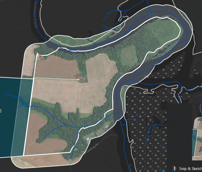
Image of a Maryland Environmental Trust easement property in Upstream Tech’s Lens system
Maryland Environmental Trust (MET) had nearly finished preparations for its spring easement monitoring season. The pandemic put a serious dent in executing MET’s plans for monitoring, which usually involves visiting properties, meeting with the property owners, and observing the landscape and land uses, all to verify adherence to conservation easement requirements. In some limited circumstances, staff were still able to make visual assessments of land use from public roadways, but for the most part, our monitoring efforts were shut down to avoid the potential of spreading the virus.
In response, staff began serious consideration of a technology called “remote monitoring.” In its earliest form this involved observers in fixed wing aircraft flying over properties and taking photographs of areas of concern. Intermediate approaches involved staff or volunteers reviewing digitally delivered high altitude aerial photography and less often, satellite imagery, in a Geographic Information System (GIS). The newest approach has resulted from significant improvements in commercial satellite technology and distribution systems, which has allowed resellers to provide affordable access to commercial high resolution satellite imagery via the internet.
In November 2020, MET began to use Upstream Tech’s Lens system online to review imagery of MET’s solely held Eastern Shore easement portfolio. Lens allows MET staff and volunteers to view easement properties with multiple dates of hi-res imagery presented side by side, and compare them by swiping back and forth, looking for changes in land use. It also allows staff to enter notes about observations, and to generate a digital or printed report that includes the photos. MET can save the reports on our server and integrate the report text directly into our easement database.
Privacy is protected as staff only scan for major changes like new construction or clearing of vegetation that has occurred since the last time an onsite visit took place. Observers also look for the presence and adequacy of waterside buffering vegetation, which helps to trap nutrients and sediment. If a change is observed, or buffers appear narrow, a digital note is made, and the property flagged for follow up by easement stewardship staff.
The imagery used is often photography that has been produced for other public agencies, but when that imagery is more than a year old MET can order high resolution satellite imagery that is acquired every few weeks by major producers such as Maxar and Airbus.
In MET’s pilot conducted between November 2020 and February 2021, staff and a handful of volunteers reviewed 145 properties and generated reports of their observations using the Lens system. We found no clear violations of easement restrictions, and only seven instances where we should clarify in our next visit what a particular object or area was used for. Similarly, there were seven instances recommended for review with the landowners, to discuss the potential for installation of wider shore or stream buffers. And this was all accomplished without putting staff, volunteers, or landowners at risk for COVID-19, while also saving travel time and fuel to visit properties and conduct an on-the-ground visit, and best of all, seeing more area of each property in less time.
MET also received a grant jointly with the Lower Shore Land Trust (LSLT) to prepare a comprehensive GIS file of LSLT’s easement holdings and to make Lens available for review of solely and jointly held conservation easements. Both organizations will now be conducting reviews, collecting data on time, reducing labor costs, and presenting results in a roundtable forum at the end of the grant period. In the meantime, MET will be working with other smaller land trusts to prepare them for potential grant applications and future use of the Lens system.
dnr.maryland.gov/met
Jon Chapman is Stewardship Manager of the Maryland Environmental Trust. Article appears in Vol. 25, No. 1 of the Maryland Natural Resource magazine.
 1-888-373-7888
 233733