
Tools of the Trade: Radio Telemetry and GPS Collars for Tracking Black Bears
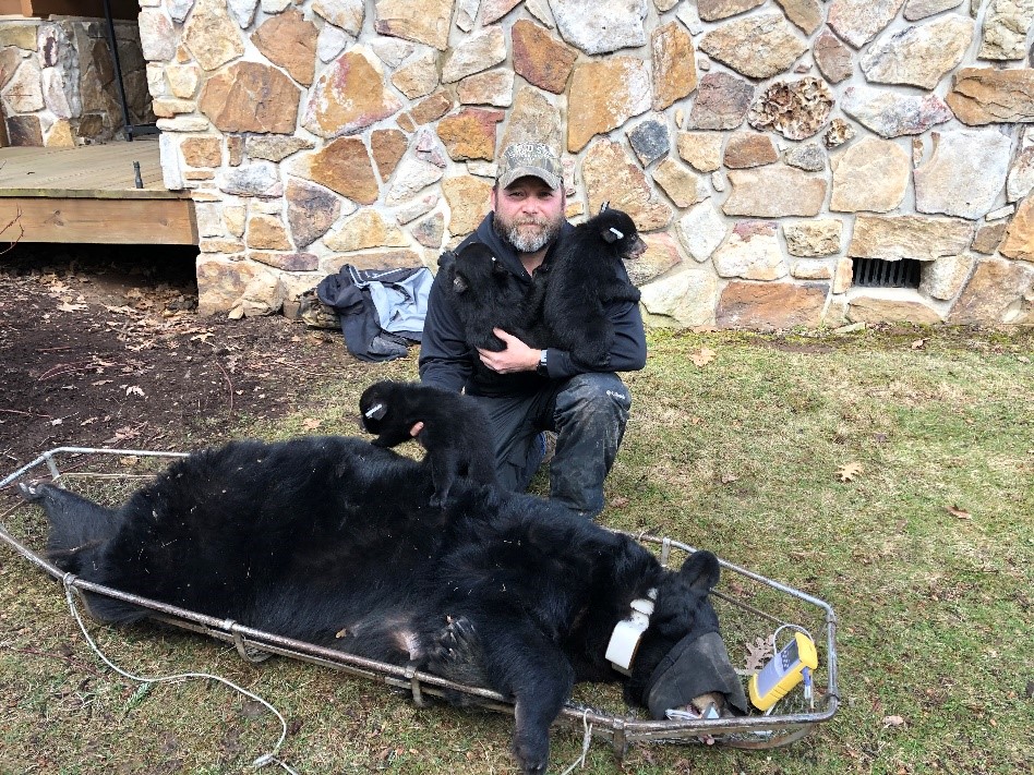
The author with a bear and three cubs removed from under a deck in Garrett County
The Department of Natural Resources has monitored and researched black bears in Western Maryland since the mid-1980s. One of the most important tools used by Wildlife and Heritage Service managers to follow these bears has been the radio collar. By using both conventional radio collars and the more modern GPS (Global Positioning System) collar, researchers can learn what habitats these wide-roaming animals use both seasonally and annually.
Other information gained through the use of this important technology includes the timing of breeding activities, den use, den site selection preferences, and even cub and yearling production and survival rates. These tools have proven invaluable for following animals that often travel in dense, difficult terrain and have home ranges greater than 10 square miles.
The department maintains a sample of radio-collared bears throughout Western Maryland in varying habitats as part of a long-range study intended to track the reproductive success and overall health of our bear population.
Each VHF (Very High Frequency) and GPS collar has a built-in radio transmitter that transmits its own individual frequency, so that researchers can tell the bears apart. This is also the method used by a researcher to locate the bear on the ground. The transmitter and battery pack are encapsulated in a durable steel and resin case designed to handle the abuse black bears tend to put them through. A steel cable antenna attached to the box is sewn between the leather belting on the collar itself, enabling the collar to transmit a signal through thick vegetation and across difficult terrain for a mile or more.
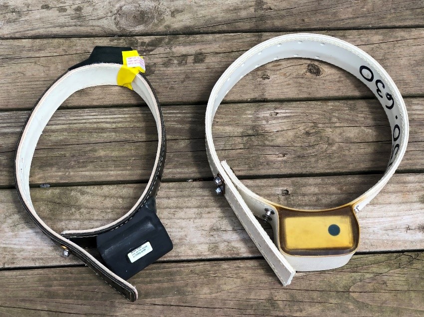
GPS (l) and VHF (r) collars used in bear research
The GPS collar has an additional box on the top portion of the collar that contains the built-in GPS unit, which can be programmed by the researcher to get a location or “fix” at predetermined intervals. Some GPS collars can be accessed live via a remote satellite link, so the researcher can get an immediate location and download data while the animal is still in the field. Other GPS collars are “store on board” models that must be physically retrieved and downloaded to the researcher’s computer.
All of the collars used by the Department of Natural Resources also contain a “mortality” sensor that sends out a different signal once a collar has laid motionless for several hours. This will let the researcher know if the animal has possibly slipped its collar, is hibernating, or has died in the field.
Each type of collar has advantages and disadvantages, which the researcher must assess to determine which is appropriate for a specific research project. At the forefront is cost and reliability – VHF collars cost about $400 each while GPS collars can cost more than $1,500 each. There can also be reliability issues with GPS collars – bears tend to like areas with thick overhead canopy where GPS fix rates are typically reduced. Also, the GPS unit puts a larger drain on the battery, which shortens the life expectancy of the collar.
To track both kinds of collars, researchers use a specialized receiver and antenna that can be programmed to receive each individual collar’s frequency. One type of antenna, the H-antenna, obtains a directional signal due to the fact that the elements at the rear of the antenna are slightly longer than the elements in the front. This design allows the researcher to narrow down the direction the signal is coming from to locate the animal on a map or walk into its location. In theory the process is simple, but practical implementation tends to be more of an art than a science. Varying conditions on the ground such as thick vegetation and mountainous terrain, and whether the animal is hiding behind a boulder or in a rock den, can drastically alter the signal, which can add up to hours of frustration for the researcher seeking the bear’s location. But in the end, it’s always fascinating to know that there is a live animal at the other end of the signal. Thanks to developments in VHF and GPS technology, we can gain valuable insights into the animal’s daily and seasonal life in a relatively noninvasive way.
Harry Spiker is the Game Mammal Section Leader for the Maryland Department of Natural Resources Wildlife and Heritage Service. Article appears in Vol. 24, No. 2 of the Maryland Natural Resource magazine, spring 2021.