
High-tech Tools Map Out Green Space Equity
 More than ever, local parks have become an essential part of everyday life for many people and critical space for communities. They provide a place to unwind after a long day, an alternative classroom for kids, a place to safely gather with family and friends, or just that special place to recharge one’s mental and physical energy. Parks and green infrastructure also play a key role in protecting communities from the harmful effects of climate change and enhancing community resilience.
Therefore, access to parks can provide important health and community benefits beyond what occurs in the park.
- Community health: Evidence shows that access to park space encourages physical activity and promotes psychological benefits for children and teens.
- Social: Green space can offer recreational opportunities, create a sense of place, and has been linked to crime reduction.
- Economic: Numerous studies have shown that access to greenspace increases property value, and even will make visitors want to shop or linger in greener areas.
- Environmental: Green spaces in cities improve air quality, provide shady respites on warmer days, and may aid in filtering stormwater runoff and increase community resilience to storms and flooding.
To ensure that all Marylanders have equal and adequate access to parks and their amenities, it is important to evaluate which communities lack nearby nature. Determining these areas is the first step in identifying resources to begin making this change in communities.
To help planners and community leaders in this effort, the Maryland Department of Natural Resources, together with the University of Maryland School of Public Health, has developed a park equity mapping tool. This tool can help local planners, park and recreation officials, and community leaders guide investments, write grants, and shape policy on where park development and enhancements occur. The Maryland Park Equity Analysis, originally launched in 2008, was updated in 2020 to include new data, widgets, and analysis capability.
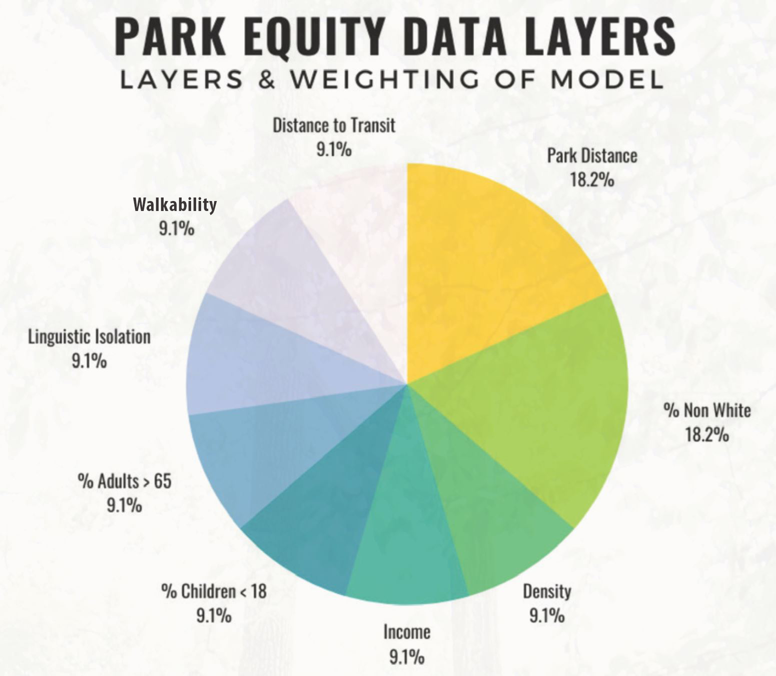
The enhanced Park Equity tool makes use of locally submitted park data, U.S. Census data, and many other relevant information layers to create a tool that can be used visually and generate numerical reports for counties, census block groups and select customized groups of interest. The tool takes into account demographic data such as population density, income percentage, nonwhite population, linguistic isolation, access to transit, and the walkability of a community.
The tool also includes an analysis of the types of park space available in communities. It evaluates both access to natural areas and recreational amenities available at the local parks. Spaces are defined two ways: “people-powered areas,” which provide “active” recreation space for physical activities or social gatherings and “natural-powered” areas, whose main attraction is nature itself. By including this analysis based on locally provided data, the tool allows for a more refined analysis of local community assets and future needs.
Another innovative feature in the Park Equity tool is the integration with the Maryland Environmental Justice Screening Tool (MD EJScreen), developed at the University of Maryland, College Park. Users can access both of the tools on the same mapper and can overlay Environmental Justice screening layers such as the combined EJ Score–a composite of several groups of factors including pollution burden (e.g. the National Air Toxins Assessment Cancer Risk), environmental effects (Lead Paint Indicator), sensitive populations (Asthma-related Emergency Room Discharges), and socioeconomic factors, such as populations in poverty. The ability to combine these data layers will allow for critical evaluation of local community burdens and help plan for locally based solutions to address some of these issues.
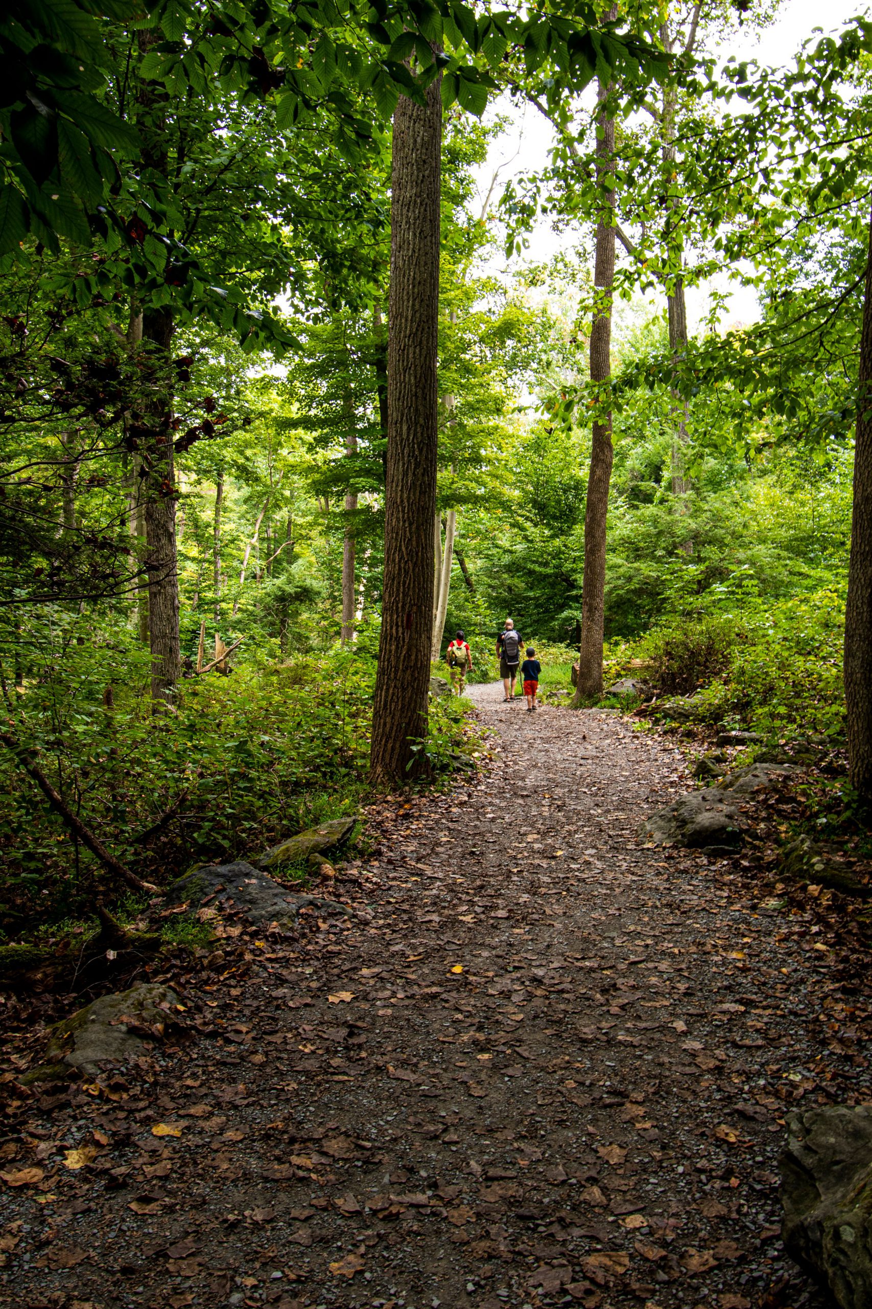
New Germany State Park Trail. Photo by Anthony Burrows.
City and town planners today are savvy at merging technical information like park equity data with on-the-ground knowledge that only they can know about their local parks. The ability to tap into a wide range of data in one place allows for a more holistic approach to planning for the location and enhancement of parks. At the same time, community leaders and planners are facing new real-life challenges. As outdoor spaces serve as classrooms, living rooms and more, it is important to make sure that everyone has access to these critical resources.
The suite that includes the park equity mapper and the environmental justice screening tool will continue to be updated with new data as it is developed. Future data will include the impacts of climate burdens on local health and equitable access to water recreation sites. The mapping team has sought input from several statewide and local stakeholders such as the Maryland Climate Change Commission, Project Green Classrooms, and the Maryland Association for Environmental and Outdoor Education, and has conducted an online survey that focuses on Maryland residents’ perceptions of their own access to green space. The team expects to include data such as flooding, canopy cover, urban heat, human health stressors, and more in the fall of 2020.
The park equity mapper is downloadable as part of the Maryland iMap toolkit and can be accessed at the Maryland Department of Natural Resources website. More information is available by contacting Sandi Olek at [email protected].
dnr.maryland.gov/publiclands/pages/ParkEquity.aspx
Sandi Olek is a planner with the Maryland Department of Natural Resources Chesapeake and Coastal Services. Article appears in Vol. 23, No. 4 of the Maryland Natural Resource magazine, winter 2021.