By Air, Land or Sea: What surveys tell us
Waterfowl, Blackwater, Smith Island; by J. Scott Bruce, Joe Subolefsky, Peter Zitta
Aldo Leopold, a well-known environmental ethicist, once penned, “Conservation is a state of harmony between men and land.”
Since conservation is at the very core of our charge here at the Maryland Department of Natural Resources, we are required to have a profound understanding of our ever-changing natural world and the impact of mankind upon it. To accomplish this task, we turn to science—and for the science, we go to extraordinary lengths.

Survey plane; by Stephen Badger
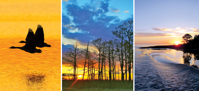
Geographically, Maryland is positioned perfectly for a great deal of migratory waterfowl; the abundance of prime habitat further incentivizes their stopover. For biologists, the presence (or absence), migration timing and relative populations provide invaluable information—not only about the birds being studied, but also the flora and fauna that sustain them and general environmental quality.
Taking to the air is simply the most effective and efficient way to understand these dynamics. In the right conditions, an increase in elevation immediately delivers greater visibility, which in turn facilitates accurate identification and counts. Through these advantages, we are able to quickly cover vast areas that would otherwise be inaccessible.
Take-off; by Stephen Badger
Vast views
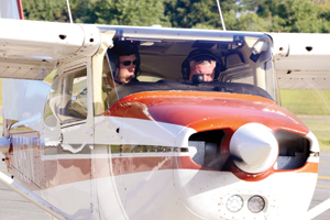
Nearly all of the Chesapeake Bay’s tidal shoreline and Atlantic Coastal Bays are surveyed. The great majority of the work is conducted by a handful of specially trained state biologists who work alongside private pilots in small, single-engine Cessnas. The Maryland Natural Resources Police provide assistance as well, using their newly reacquired helicopter, Natural 1. It allows for slower passes over salt marsh plots, enabling better visibility.
All remaining surveys are performed by our colleagues at the U.S. Fish and Wildlife Service—particularly when they’re necessary over restricted airspace and adjacent areas, or open stretches of water where federally owned “float planes” afford pilots and observers greater access and safety.
Seasons of data
Surveys are conducted annually in spring, fall and winter, with each season focusing on the collection of different information.
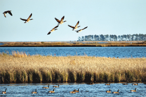
Canada geese; by Chuck Prahl
In springtime, we count the number of breeding waterfowl—typically mallards, black ducks and Canada geese. The data collected feeds into population models at the Continental, flyway and local scales. Colleagues and counterparts in other states collect similar information. The U.S. Fish and Wildlife Service uses the totals to inform management decisions such as hunting season length and bag limits.
In the fall, we concentrate our efforts on the mute swan, an invasive species that wreaks havoc upon underwater bay grasses. Information provided by aerial surveys has tracked control efforts, bringing the population down from a one time high of approximately 4,000 to about 40 individuals today.
Perhaps the most intensive survey is for wintering waterfowl. In the first two weeks of January, our biologists observe huge numbers of Canada geese, canvasbacks, mallards, ruddy ducks, scaup and tundra swans, among others. Here the mission is not so much an annual population study as it is a means to develop a year-to-year index so we can best understand long-term trends. Further, for species such as Atlantic brant and tundra swans, our midwinter survey provides the only annual population estimates, given the remote nature and inaccessibility of their arctic breeding grounds.
TAKING IT TO THE STREETS
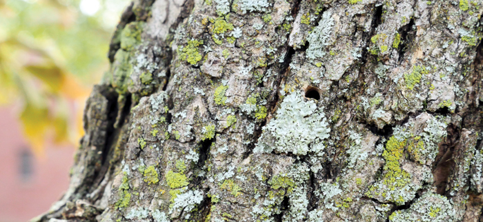
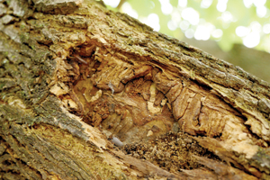
Infected ash tree (note the small, D-shaped hole); by Stephen Badger
The words “urban” and “forestry” seem an unlikely pairing, but the practice is actually quite commonplace. Cities are home to untold millions of trees—scattered throughout our communities, parks and even lining the busiest of thoroughfares.
Their presence may be overlooked, but their impact upon our daily lives is far from nominal. Whether appreciated aesthetically or environmentally, the benefits provided by trees are numerous.
City-dwelling trees face a litany of challenges that their country cousins simply do not: air and water pollution, constrained habitat and a closer relationship with their human neighbors. To mitigate the hazards and promote a healthy balance with humanity, we turn to the professionals—urban foresters.
Emerald ash borer galleries; by Stephen Badger
City canopy
The pursuits of an urban forester are as diverse as the species they serve—planning, planting, pruning and removal being the most typical. But the atypical is oftentimes equally important.
Currently, state foresters are working at the request of Baltimore County to inventory and assess Dundalk’s ash tree population, which has been devastated by the emerald ash borer—an invasive beetle from Southeast Asia. Aside from the unsightly look of dead or dying trees, there are a host of other concerns.
Affected ash trees are notoriously brittle. Their low moisture content leads to cracks and buckles within the bark, and provides for easy breakage of limbs or the trunk itself. As its health declines, parts of the tree may find their way to sidewalks and streets, creating safety concerns as well as potentially impacting power and telephone lines, emergency evacuation routes and more.
Mitigation
To conduct the survey, foresters will painstakingly drive up and down every street in the studied area, documenting their progress on a map as they go.
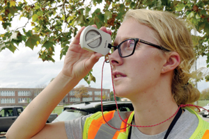
Clinometer measurement; by Stephen Badger
They look specifically for trees in the planting zones between sidewalks and the street—areas that are generally in the county’s right of way. As foresters encounter each tree, its location is documented. A specially calibrated tape is used to measure the diameter at breast height, about 1.37 meters from the ground.
Next, staff measures the height with a clinometer by counting off paces from the trunk, and then sighting to the base and the highest point of the canopy. Lastly, they’ll assess the overall condition of the tree.
At the survey’s conclusion, collected information will be passed on to staff with the Baltimore County Bureau of Highways, who use the data to inform their own management decisions.
BELOW THE SURFACE
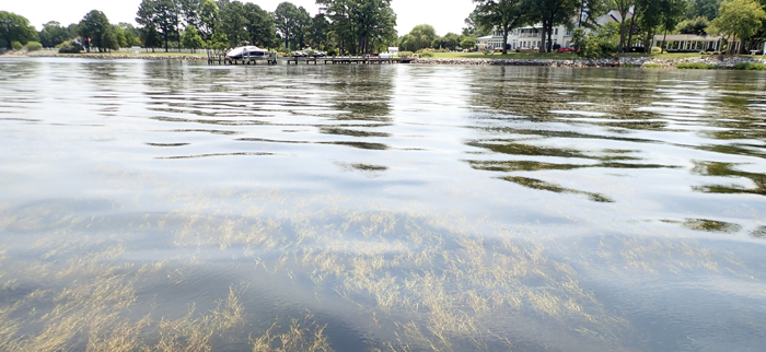
Miles River widgeon grass bed; staff photo
It’s hard to overstate the connection Marylanders have to the water. Its importance is palpable—culturally, economically, environmentally and recreationally.
Promoting the vitality of these waters is an important mission for the department and the watershed.
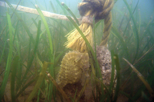
Seahorse in eelgrass; staff photo
Super plants
Fortunately, we have a natural ally in this fight: submerged aquatic vegetation, more commonly called bay grasses. The Chesapeake Bay is home to more than 20 such species, but the more common finds are eelgrass, redhead grass, wild celery and widgeon grass.
The plants not only oxygenate the water and provide habitat for crabs and fish, but also serve as a food source for waterfowl, slow erosion by buffering wave energy, settle out particulates and stabilize shoreline.
Department biologists have led countless campaigns focused on bay grasses. Last year, we wrapped up a 6-year study for the National Oceanic and Atmospheric Administration to assess the density, diversity and resiliency of submerged aquatic vegetation communities throughout the bay, comparing riprap against natural shorelines.
We also have been quite active in Deep Creek Lake, both in studying native populations and working to eradicate the invasive hydrilla.

Landry preparing for a dive; staff photo
Public participation
Most recently, we’ve been working with a host of local watershed organizations, helping to train citizen scientists to inventory and monitor bay grasses.
Using distribution maps provided by the Virginia Institute of Marine Science, volunteers make their way to underwater grass beds to identify the particular species present. The data collected comes back to the department and is shared with Virginia, contributing to a detailed, long-term dataset. In some instances, volunteers have also identified areas where replanting efforts are necessary and worked to collect seeds to further the process.
Though originally focused on force multiplication, this approach has also provided a more robust sense of stewardship for local waterways, and the accompanying education and outreach within neighboring communities have engaged constituents and stakeholders—a result as valuable as the collected data.
These are but a few samplings of the department’s many undertakings. Our agency is fortunate to have a great number of dedicated professionals who will stop at nothing in service to the natural world and humans who live, work and play within it.
Article by Stephen Badger—public information officer. Appears in Vol. 21, No. 1 of the Maryland Natural Resource magazine, winter 2018.