DHCD Launches New Neighborhood Revitalization Project Mapper
The Neighborhood Revitalization Award Mapper provides detailed information on all DHCD Neighborhood Revitalization programs and projects from FY 2019-present including information on location, award amount, project name and project description.
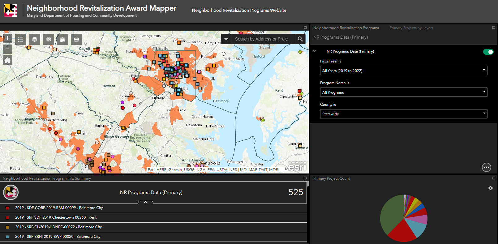
DHCD has launched its new GIS (Geographic Information System) interactive mapping application, Neighborhood Revitalization Award Mapper, that gives users the ability to identify and look up detailed information on all DHCD’s Neighborhood Revitalization programs and projects from Fiscal Year 2019-present. The map and source data contain visual resources in “bird’s eye view” to help provide address level information and program descriptions to policy-makers and partners. The state revitalization projects and programs are displayed through various addresses separated by counties, grant year, award amount, and funding sources.
The Neighborhood Revitalization team has worked diligently to provide the essential data needed to provide transparency, and show where state resources are going. The programs and projects represented in this mapping tool demonstrate where DHCD has partnered with local governments, nonprofits, and other stakeholders to support revitalization efforts that enhance the quality of communities and the quality of life for our citizens.
This map is a powerful tool for identifying where community projects are being completed. With Neighborhood Revitalization’s goal to update this map monthly, users will be able to evaluate the extensive growth of its ongoing and successful projects and awards for years to come.